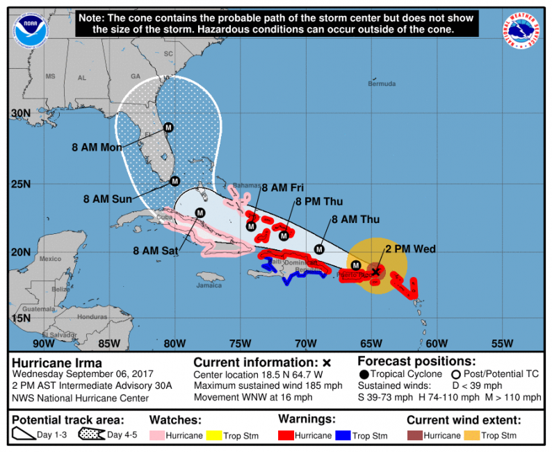
As of 2 PM Eastern the National Hurricane Center has released their latest advisory on Irma, and these advisories will continue coming every 3 hours until the storm dissipates. Irma still has sustained winds of 185 mph and is an extremely powerful category 5 hurricane. The National Hurricane Center has also adjusted their track to account for a slight eastward shift in the majority of model guidance overnight last night and into this morning.

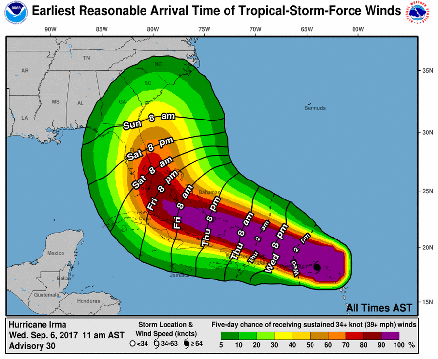
Confidence continues to increase with the eventual path and scope of impacts as well, as we now see far higher odds of tropical storm-force winds across southeastern Florida.

We had expected to see rapidly decreasing uncertainties by today, and that is now becoming more apparent. Models are consistent in showing only very gradual weakening of the system, with at least 36-48 more hours of category 5 status likely (courtesy of Tropical Tidbits).
One clear example of these decreasing uncertainties lies in the latest 12z run of the American GEFS. The new ensemble members in total have a significantly smaller spread than previous runs, with almost all showing significant impacts for southeastern Florida (courtesy of weathernerds.org). There are far fewer that sit outside the consensus than previous runs and they are all clustered very tightly through the next few days before diverging more as the storm approaches the Southeast.

Most other weather models show a similar track as the storm approaches Florida, which is a rather new development. Canadian, European, and English (UKMET) guidance all show the storm passing right near Miami with significant impacts to the region. The whole cone in the NHC forecast shown above remains a possibility at this time, but confidence is increasing in very significant impacts to southeastern Florida, with the main question now being whether the storm makes direct landfall over the region or remains just offshore before sliding up the east coast of Florida and making landfall likely in either Georgia or South Carolina.


Leave A Comment